
Jul 27, 2018 BLOG
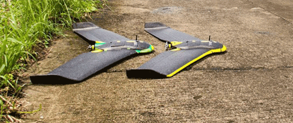
Even well-managed and planned project face constant challenges like the issue of rehabilitation including villages affected due to the Sardar Sarovar project.In a first, we deployed drones for the Narmada Development Division, Maharashtra to take georeferenced imagery of affected villages in Maharashtra after similar proof of concepts have been carried out by us in several different projects of Maharashtra government.
As we have witnessed in our early works, India is gravitating towards an urge to track growth and evaluate impact across urban and rural areas. Evidence based decisions are increasingly becoming critical to interventions and delivery of services. In such a scenario, access to reliable grassroots data becomes crucial for holistic and inclusive policy making and successful implementation.
Our first-mile challenge was to provide reliable, relevant and actionable data especially in the rural sector that is largely unorganized and unmappable due to remote habitable areas where satellite imaging doesn’t provide sufficient detailing.
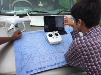
Over the course of three days, our team collected data to create detailed 2D base maps and 3D terrain models.We then further expanded our activities, visiting all nearby villages to ensure boundaries, providing local officials with digital high-resolution maps they could use to assess the situations in their region and plan reconstruction efforts based on current, accurate data.
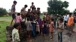
Known as Sardar Nagar, is a settlement of merely 100 residents, it is located 34 KM towards North from District head quarters Nandurbar and 372 KM from state capital Mumbai was where Aerizone started its work, rolling out a project to provide the most vulnerable villages with a digital identity.
To date, Aerizone has built digital accurate maps for 12 villages and working with the officials to cover more than 100 villages for accurate assessment, see where people are currently living, monitor reconstruction work and more.
Given the remoteness of the affected villages, there was little information available on Google Maps and as such planning for infrastructure services was a long delayed decision owing to lack of substantial evidence to showcase. Our intention of using visual imagery with survey data was to help local authorities identify service delivery gaps and local needs.
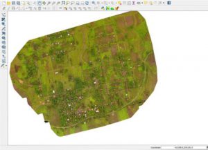
After processing the data it was further analyzed with the existing rehabilitation layouts, in this process all the existing land usage were marked.To this extent, innovative research methodologies and practices need to be incorporated to ensure that data collected is robust, informative, and authentic.