From the Leaders in Drone Data Technology
Drone Survey in India is transforming the way infrastructure, engineering, construction, mining, utilities, railways, renewable energy, and government projects are planned and executed. Traditional land surveying methods often require extensive manpower, longer project durations, and significant operational costs. Modern UAV technology has revolutionized surveying by enabling faster, safer, and highly accurate data acquisition over large and complex project sites.
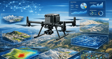
At Aerizone, we provide professional drone survey services across India using advanced RTK, PPK, LiDAR, and photogrammetry technologies. Our experienced team delivers engineering-grade aerial surveys that help consultants, EPC contractors, government departments, infrastructure developers, and industrial organizations make faster and more informed decisions.
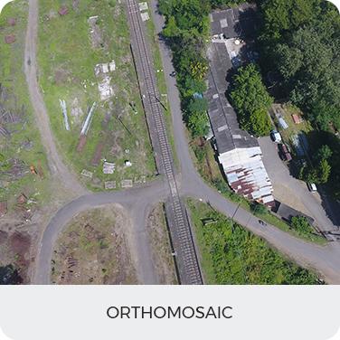
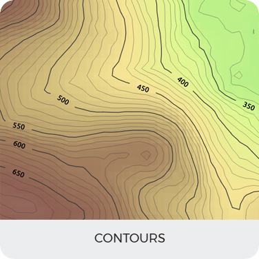
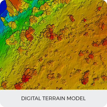
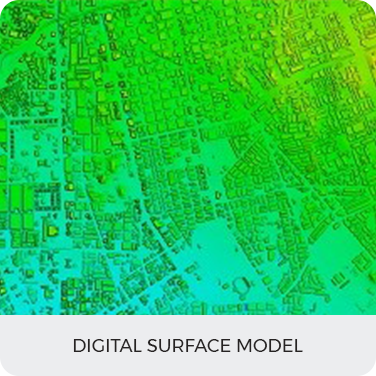
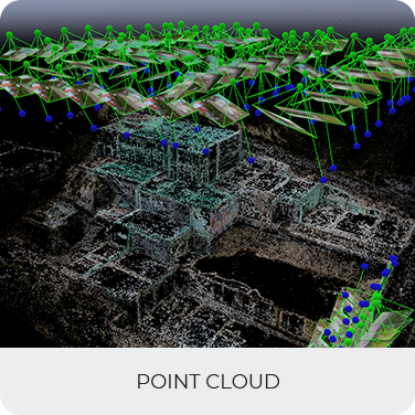
Unlike conventional aerial photography, our drone survey solutions generate actionable geospatial intelligence. We convert raw aerial data into orthomosaic maps, Digital Elevation Models (DEM), Digital Surface Models (DSM), contour maps, point clouds, volumetric calculations, and GIS-ready datasets compatible with AutoCAD Civil 3D, ArcGIS, Bentley, and BIM platforms.
Whether the project involves highways, railways, mining operations, transmission lines, industrial plants, dams, irrigation canals, smart cities, or renewable energy projects, Aerizone provides reliable drone survey in India with engineering accuracy, faster turnaround, and comprehensive reporting. By integrating modern UAV platforms with advanced processing software, we help clients reduce survey timelines, improve safety, optimize project planning, and enhance operational efficiency.
Today, organizations across India are increasingly adopting UAV survey solutions to improve project execution, monitor construction progress, calculate earthwork volumes, inspect inaccessible assets, and maintain accurate digital records throughout the project lifecycle. Aerizone combines technical expertise with state-of-the-art drone technology to deliver survey solutions that meet the evolving requirements of infrastructure and industrial development.
A drone survey is the process of collecting accurate geospatial data using Unmanned Aerial Vehicles (UAVs) equipped with high-resolution cameras, RTK positioning systems, LiDAR sensors, or other advanced payloads. Compared with traditional land surveying, drone surveys capture millions of data points in a single flight, enabling rapid creation of orthomosaic maps, topographic surveys, 3D models, contour maps, Digital Elevation Models, Digital Surface Models, and engineering-grade point clouds.
Drone surveys significantly improve project efficiency by reducing field time, minimizing human error, and safely accessing difficult or hazardous locations. The collected aerial data is processed using professional photogrammetry and GIS software to generate highly accurate deliverables that support planning, design, construction, inspection, and asset management.
From infrastructure development and mining to railways, utilities, water resources, and renewable energy, drone survey services have become an essential component of modern engineering workflows.
Traditional surveying methods remain valuable for many engineering applications, but modern infrastructure projects increasingly require faster data collection, broader coverage, and frequent updates. Drone surveys complement conventional surveying by providing rapid aerial intelligence while maintaining engineering-grade accuracy.
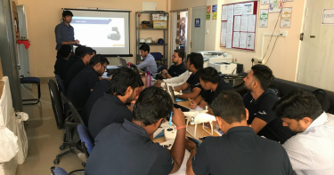
Become a drone pilot and learn to use our software process and analyze data
LEARN MORE
As startup being recognized by the startupInidia initiative by the Department
LEARN MORE
Become a drone pilot and learn to use our software process and analyze data
LEARN MORE