Loading

AERIZONE SERVICES

From the Leaders in Drone Data Technology

2D/3D Mapping

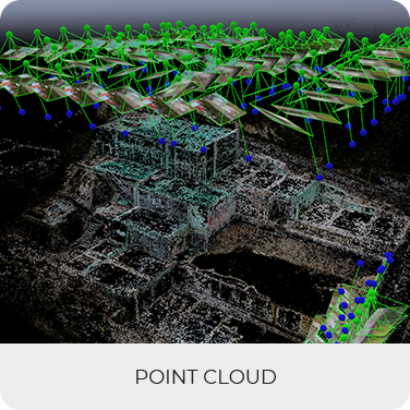
2D/3D mapping has become an essential tool for modern infrastructure development, engineering, urban planning, mining, construction, utilities, and environmental management projects. Traditional mapping methods often require extensive fieldwork, lengthy processing times, and significant manpower. Today, advanced drone technologies combined with photogrammetry and geospatial analytics provide faster, safer, and more accurate mapping solutions.

Through the integration of UAV platforms, high-resolution sensors, and advanced processing software, organizations can generate highly detailed maps and three-dimensional models that support planning, design, monitoring, and decision-making. Modern drone mapping services allow large areas to be captured quickly while maintaining engineering-grade accuracy.

At Aerizone, our 2D/3D mapping services transform aerial data into precise geospatial deliverables that provide valuable insights into terrain, infrastructure, and project conditions. By leveraging advanced UAV mapping solutions, drone photogrammetry, and GIS technologies, we help clients visualize complex environments and improve project outcomes.

Whether for infrastructure planning, corridor development, construction monitoring, mining operations, or asset management, our mapping solutions provide accurate and reliable information that supports informed decision-making throughout the project lifecycle.

Applications of 2D/3D Mapping

  • Infrastructure Development: Infrastructure projects require accurate geospatial information for planning and execution. Our infrastructure mapping services support highways, railways, transmission corridors, industrial facilities, and urban development projects through detailed aerial mapping and analysis.
  • Construction Planning and Monitoring: Construction teams use 3D site mapping and aerial mapping services to track project progress, verify site conditions, and compare construction activities against design plans.
  • Mining and Quarry Operations: Mining organizations rely on 3D terrain modeling and drone survey mapping for stockpile measurements, volumetric analysis, pit monitoring, and operational planning.
  • Corridor Mapping: Roads, railways, pipelines, canals, and transmission lines benefit from UAV mapping solutions that provide accurate corridor data for route planning and engineering analysis.
  • Urban and Regional Planning: Urban planners utilize geospatial mapping services to analyze land use, infrastructure requirements, zoning regulations, and future development opportunities.
  • Environmental Monitoring: 2D and 3D mapping support environmental assessments, watershed analysis, vegetation monitoring, and land management initiatives.

Benefits

  • Capture large geographic areas quickly while maintaining high levels of accuracy and consistency.
  • Generate detailed visual representations that improve project planning and stakeholder communication.
  • Reduce field survey time and operational costs through efficient aerial data collection.
  • Support engineering, GIS, CAD, and BIM workflows with accurate mapping deliverables.
  • Improve decision-making through high-resolution aerial intelligence and terrain analysis.
  • Enhance safety by reducing the need for personnel to access difficult or hazardous locations.
  • Provide scalable mapping solutions suitable for infrastructure, industrial, and government projects.
  • Enable accurate measurements, volume calculations, and spatial analysis for complex projects.

Deliverables

Orthomosaic
Contours
Digital Terrain Model
Digital Surface Model
Point Cloud

Other Services

blog
Inspection

We're experts at data collection, management, and its analysis at Aerizone

LEARN MORE
blog
UAV training

As startup being recognized by the startupInidia initiative by the Department

LEARN MORE
blog
Drone Repairs

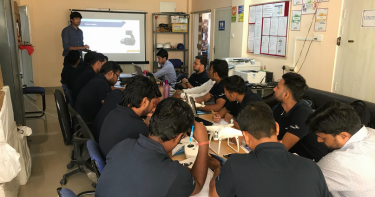
Become a drone pilot and learn to use our software process and analyze data

LEARN MORE
blog
UAV Data Processing

With the growing need of drone based professional data processing

LEARN MORE
blog
Drone Survey

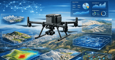
At Aerizone, we specialize in drone surveys that transform aerial data into precise maps, models, and intelligence.

LEARN MORE

Drone solutions that matter for you