Loading

AERIZONE INDUSTRIES

From the Leaders in Drone Data Technology

CONSTRUCTION

Drone construction monitoring is transforming the way infrastructure and construction projects are planned, tracked, and managed. Modern construction environments demand real-time visibility, accurate progress analysis, and efficient project coordination. Traditional monitoring methods often rely on manual inspections, static drawings, and delayed reporting, making it difficult to identify issues quickly or maintain complete project transparency.

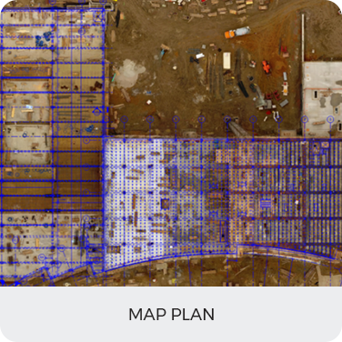
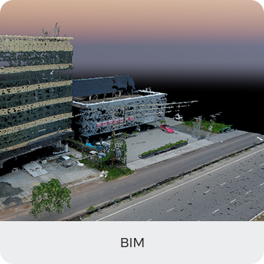
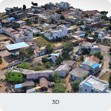
By integrating UAV technology into construction workflows, organizations can capture high-resolution aerial data, monitor site activities in real time, and generate precise 2D and 3D project visualizations. Drone-based monitoring enables construction teams to shift from reactive decision-making to proactive project management by delivering accurate aerial analytics throughout the project lifecycle.

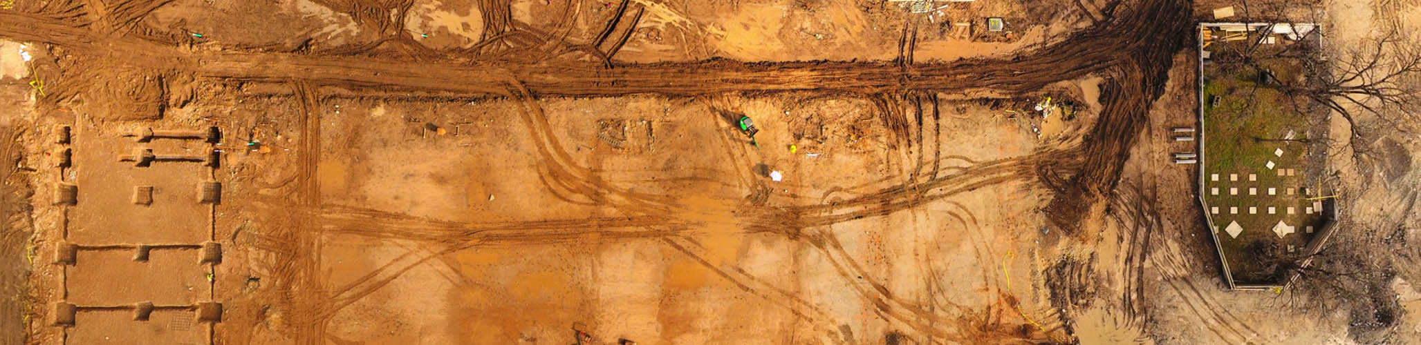
Instead of relying only on CAD drawings and manual documentation, aerial data provides a more comprehensive understanding of site conditions. Drone surveys can capture detailed imagery, terrain data, and construction progress within a short timeframe, helping engineers, consultants, and project managers make faster and more informed decisions.

Aerizone’s advanced UAV construction monitoring solutions help organizations improve site visibility, optimize workflows, and maintain better coordination between field operations and office teams. Through high-precision aerial mapping and drone analytics, we provide actionable insights for infrastructure projects, industrial developments, highways, railways, and commercial construction sites.

Applications of Drone Construction Monitoring

  • Construction Progress Monitoring: Using construction progress monitoring drones, project teams can compare real-time aerial data with project timelines and planned designs to ensure work progresses according to schedule.
  • Drone Site Mapping: High-resolution drone site mapping helps engineers visualize layouts, monitor changes, and maintain accurate records of construction activities.
  • Infrastructure Development: Drone mapping for construction projects supports highways, bridges, industrial facilities, rail corridors, and urban infrastructure developments with accurate aerial intelligence.
  • Volumetric Analysis: Drone volumetric analysis enables precise measurement of stockpiles, excavation quantities, and earthwork movement, improving resource management and cost estimation.
  • Drone Inspection for Construction Sites: Drone inspections help monitor structural elements, rooftops, façades, scaffolding, and difficult-to-access areas without disrupting site operations.
  • Construction Safety Monitoring: Aerial drones for construction safety improve hazard detection and reduce the need for personnel to access risky environments.
  • BIM and GIS Integration: Drone photogrammetry and aerial mapping data can be integrated with BIM and GIS platforms to support digital construction workflows and engineering analysis.

Benefits

  • Keep projects on track and on budget through access to accurate and up-to-date aerial site data.
  • Improve productivity by connecting field operations with office teams through real-time aerial documentation.
  • Enhance construction progress tracking with frequent drone-generated reports and visual analytics.
  • Improve project planning and decision-making using high-resolution aerial imagery and 3D mapping outputs.
  • Reduce safety risks by inspecting hazardous or difficult-to-access construction zones remotely.
  • Monitor stockpiles, excavation volumes, and earthwork quantities accurately through drone volumetric analysis.
  • Track assets and document every stage of the project lifecycle with aerial project records.
  • Support BIM and GIS workflows with drone-generated mapping data and engineering-ready deliverables.

Deliverables

Map Plan
BIM
3D View

Contact us today to see what we can do for your business

CONTACT US