From the Leaders in Drone Data Technology
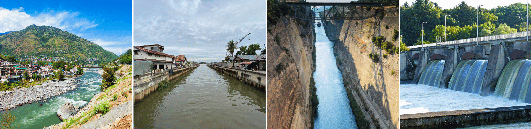
Drone Mapping for Water Resource Management is transforming the way governments, engineering consultants, irrigation departments, and infrastructure agencies plan, monitor, and manage critical water resources. Conventional surveying methods often require extensive fieldwork, longer project timelines, and repeated site visits, making them less efficient for surveying large reservoirs, river basins, irrigation networks, dams, and flood-prone regions. Modern drone survey technology provides a faster, safer, and more accurate approach to collecting high-resolution geospatial data that supports informed decision-making throughout the lifecycle of water infrastructure projects.
Water is one of the world’s most valuable natural resources, and effective water resource management depends on accurate spatial information. Whether planning a new reservoir, monitoring canal networks, analysing catchment areas, assessing flood risks, or conducting submergence analysis, engineers require reliable datasets that traditional survey techniques cannot always deliver within project timelines. Drone mapping bridges this gap by capturing detailed aerial imagery and terrain information in a fraction of the time while maintaining engineering-grade accuracy.
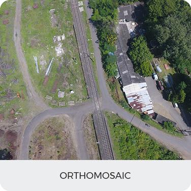
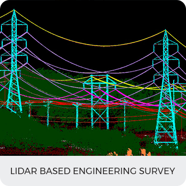
Aerizone specializes in Drone Mapping for Water Resource Management, delivering end-to-end geospatial solutions using advanced UAV platforms equipped with RTK, PPK, LiDAR, and photogrammetry technologies. Our services support irrigation projects, hydrology studies, flood management initiatives, dam inspections, watershed assessments, and reservoir monitoring across India. By combining drone mapping, GIS mapping, orthomosaic mapping, and drone photogrammetry, we provide accurate datasets that help government agencies, EPC contractors, consultants, and infrastructure developers make faster and more confident decisions.
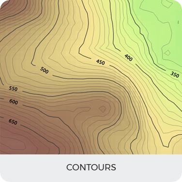
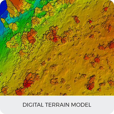
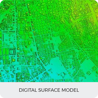
Unlike conventional aerial photography, Aerizone converts raw aerial data into engineering-ready deliverables, including orthomosaics, Digital Elevation Models (DEM), Digital Surface Models (DSM), contour maps, 3D terrain models, and GIS-ready datasets. These outputs integrate seamlessly with engineering software, enabling planners and decision-makers to optimise project execution while reducing survey costs and improving operational efficiency.
As climate change, rapid urbanisation, and increasing demand for water place greater pressure on existing infrastructure, modern UAV mapping solutions are becoming indispensable. Drone-based surveys not only improve planning and monitoring but also provide valuable historical datasets that allow project teams to compare site conditions over time. This supports sustainable water management practices while reducing environmental impact and improving long-term asset performance.
Modern water infrastructure projects require accurate, timely, and reliable geospatial information to support planning, construction, operation, and maintenance activities. Drone mapping has emerged as a powerful solution for collecting engineering-grade data across vast geographical areas with exceptional accuracy and speed. Using advanced UAV platforms, organizations can efficiently monitor reservoirs, canals, rivers, dams, watersheds, and flood-prone regions while minimizing operational costs and field risks.
Aerizone provides comprehensive Drone Mapping for Water Resource Management services that support every stage of the project lifecycle. From pre-construction feasibility studies to post-construction monitoring and environmental assessments, our drone survey solutions generate high-quality datasets that integrate seamlessly with GIS, CAD, and BIM platforms.
Our water resource management solutions include:
Each application is designed to deliver accurate geospatial intelligence that improves planning, supports regulatory compliance, and enables data-driven decision-making.
Reservoir development and river valley projects require accurate submergence analysis to understand how rising water levels will affect surrounding land, infrastructure, vegetation, and human settlements. Conventional surveys often struggle to capture the level of detail required across large and inaccessible areas. Drone Mapping for Water Resource Management provides a highly efficient alternative by generating detailed topographic datasets that support precise submergence modelling and impact assessments.
Aerizone uses advanced drone survey and GIS mapping technologies to collect high-resolution aerial imagery and terrain information for reservoir and dam projects. By integrating drone photogrammetry with RTK-enabled UAV systems, we create highly accurate orthomosaics, contour maps, Digital Elevation Models (DEM), and three-dimensional terrain models that enable engineers to determine potential submergence zones with confidence.
Drone-based submergence analysis plays a critical role in reservoir planning, Full Reservoir Level (FRL) studies, rehabilitation and resettlement planning, environmental impact assessments, and land acquisition surveys. Project authorities can accurately identify villages, agricultural land, forests, roads, and infrastructure that may be affected by changing water levels, allowing timely planning and informed decision-making.
Our drone mapping solutions significantly reduce the time required for field surveys while improving overall data accuracy. Compared to traditional methods, UAV-based mapping enables engineers to monitor water spread areas, compare seasonal changes, and maintain historical records for future reference. These datasets also support hydraulic modelling, reservoir capacity assessments, and long-term water storage planning.
Efficient water resource management depends on the effective planning, design, and monitoring of irrigation infrastructure. As agricultural demand increases and water availability becomes more unpredictable, irrigation authorities and engineering consultants require accurate spatial information to optimize water distribution and maximize resource utilization. Drone Mapping for Water Resource Management provides a modern approach to irrigation planning by delivering high-resolution aerial data that significantly improves project accuracy and decision-making.
Traditional irrigation surveys often involve extensive field measurements, manual data collection, and prolonged project timelines. Large canal networks, command areas, distributaries, and field channels can be difficult to survey using conventional methods alone. By integrating drone survey, drone mapping, and GIS mapping, Aerizone enables project teams to capture detailed terrain information across large geographical areas within a short period while maintaining engineering-grade precision.
Drone-based mapping supports every stage of irrigation infrastructure development, from feasibility studies and route selection to construction monitoring and long-term asset management. High-resolution aerial imagery combined with Digital Elevation Models (DEM) and contour mapping allows engineers to evaluate natural drainage patterns, identify elevation changes, and optimize canal alignment before construction begins.
Our UAV mapping solutions also assist irrigation departments in developing command area maps that accurately define water distribution zones. These datasets improve irrigation scheduling, reduce water losses, and support sustainable agricultural development by ensuring efficient utilization of available water resources.
Using advanced orthomosaic mapping, engineers can monitor existing canal networks to identify structural damage, erosion, illegal encroachments, vegetation growth, and maintenance requirements. Regular drone surveys create historical records that enable authorities to compare infrastructure conditions over time and prioritize maintenance activities based on actual field conditions.
For new irrigation projects, drone mapping significantly reduces survey duration while improving data quality. The resulting GIS-ready datasets integrate seamlessly with engineering software, allowing consultants to perform hydraulic analysis, optimize network layouts, and support environmental approvals.
Aerizone’s expertise in drone photogrammetry, RTK-enabled surveys, and geospatial analytics ensures that every irrigation project benefits from reliable, accurate, and actionable spatial intelligence. Whether supporting canal modernization programs, micro-irrigation planning, or large-scale irrigation schemes, our drone mapping services provide the foundation for smarter water infrastructure development.
Hydrological studies form the foundation of every successful water resource management project. Understanding how water moves across a landscape is essential for reservoir planning, watershed management, river engineering, flood mitigation, groundwater recharge, and environmental conservation. Traditional hydrological surveys often require multiple field visits, extensive manual measurements, and significant processing time. Drone Mapping for Water Resource Management offers a faster, safer, and more comprehensive solution by generating highly accurate terrain and surface datasets for hydrological analysis.
Aerizone utilizes advanced drone survey technologies combined with RTK positioning, drone photogrammetry, and GIS mapping to collect high-resolution spatial information across rivers, watersheds, reservoirs, and catchment areas. These datasets enable hydrologists, engineers, and planners to better understand drainage networks, runoff patterns, terrain characteristics, and watershed boundaries with exceptional accuracy.
One of the primary advantages of drone mapping is the ability to generate detailed Digital Elevation Models (DEM) and Digital Surface Models (DSM) that accurately represent the terrain. These models are essential for identifying natural drainage paths, determining watershed boundaries, analyzing slopes, and supporting rainfall-runoff modelling. Such information is critical for designing water conservation structures, optimizing reservoir capacity, and improving watershed management strategies.
Drone-based hydrological surveys also provide valuable information for sedimentation studies, erosion monitoring, river morphology analysis, and environmental impact assessments. Engineers can compare historical datasets over time to understand changes in river channels, identify sediment accumulation, and evaluate the effectiveness of water conservation measures.
By integrating aerial imagery with GIS platforms, Aerizone creates intelligent spatial databases that support decision-making across government agencies, irrigation departments, environmental consultants, and infrastructure developers. These datasets enable planners to perform advanced geospatial analysis, prepare hydrological models, and improve long-term water resource planning.
Our drone mapping services significantly reduce survey time while minimizing the risks associated with accessing remote or difficult terrain. Large catchment areas, mountainous regions, river basins, and environmentally sensitive zones can be surveyed safely without disrupting ongoing operations.
With increasing climate variability and growing pressure on natural water resources, reliable hydrological data has become more important than ever. Aerizone combines engineering expertise with advanced UAV technologies to deliver accurate, GIS-ready datasets that support sustainable water management initiatives throughout India.
Applications of Drone Mapping for Hydrology
Floods remain one of the most destructive natural disasters, causing extensive damage to infrastructure, agriculture, industries, and human settlements. Effective water resource management requires accurate flood risk assessment, real-time monitoring, and rapid post-disaster analysis to minimize economic losses and improve emergency response. Traditional flood surveys are often time-consuming and difficult to conduct during or immediately after flooding events. Drone Mapping for Water Resource Management enables authorities to capture accurate aerial information safely, quickly, and efficiently.
Aerizone utilizes advanced drone survey technologies integrated with RTK positioning, GIS mapping, and drone photogrammetry to generate high-resolution datasets that support flood preparedness, emergency planning, and disaster recovery. Drone-based surveys provide detailed orthomosaics, elevation models, and flood inundation maps that help engineers and disaster management authorities understand the extent and impact of flooding with remarkable accuracy.
One of the major advantages of drone mapping is the ability to rapidly deploy UAVs immediately after flood events. This allows project teams to assess damaged infrastructure, monitor breached embankments, inspect irrigation canals, identify blocked drainage systems, and evaluate the condition of roads, bridges, and hydraulic structures without exposing personnel to hazardous conditions.
By combining Digital Elevation Models (DEM), contour mapping, and hydrological datasets, drone mapping also supports predictive flood modelling and floodplain analysis. Engineers can identify vulnerable areas, simulate flood scenarios, and develop effective mitigation strategies for future events.
Aerizone’s flood management solutions assist government agencies, irrigation departments, municipal authorities, disaster management organizations, and engineering consultants in improving resilience against flood-related risks. Through accurate geospatial intelligence, stakeholders can make faster decisions regarding evacuation planning, infrastructure rehabilitation, and long-term flood mitigation projects.
Regular drone surveys also establish historical datasets that allow authorities to compare seasonal flood patterns and evaluate changes in river morphology, drainage systems, and watershed conditions over time. This supports better planning and more sustainable management of water resources across urban and rural environments.
Aerizone combines advanced UAV platforms with modern geospatial technologies to deliver engineering-grade solutions for Drone Mapping for Water Resource Management. Every project is executed using industry-leading hardware, positioning systems, and data processing workflows to ensure reliable and highly accurate outputs.