Loading

AERIZONE INDUSTRIES

From the Leaders in Drone Data Technology

BIM

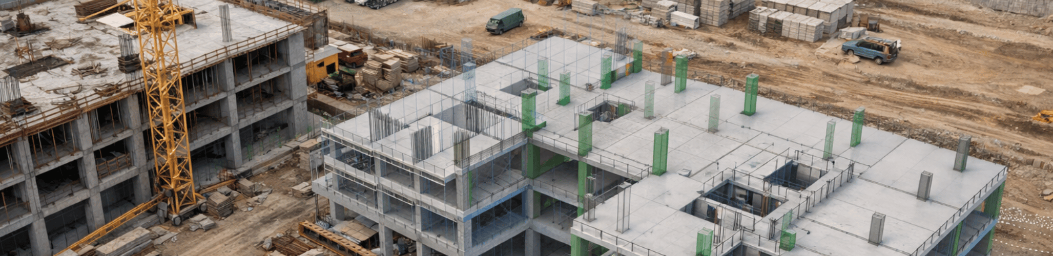
BIM drones in construction are transforming the way modern infrastructure and building projects are designed, monitored, and executed. By combining advanced drone mapping technologies with Building Information Modeling (BIM), project teams can capture high-resolution aerial data, generate accurate 3D site models, and integrate real-world conditions directly into digital construction workflows.

Traditionally, BIM models were created primarily from design drawings, satellite imagery, and manual surveys. While these methods provide valuable information, they often require significant time for data collection and validation. Drone technology enables a faster and more precise approach. With UAV mapping and drone photogrammetry, construction teams can collect detailed site data within minutes and convert it into accurate models that seamlessly integrate with BIM platforms.

The integration of drone-generated data with BIM models allows engineers, architects, and construction managers to visualize projects more clearly, track site progress, and identify potential issues early. This combination improves collaboration between stakeholders and ensures that construction decisions are based on accurate, up-to-date information.

Aerizone provides advanced BIM drone mapping services that support construction planning, infrastructure development, and digital project management by delivering precise aerial data for BIM workflows.

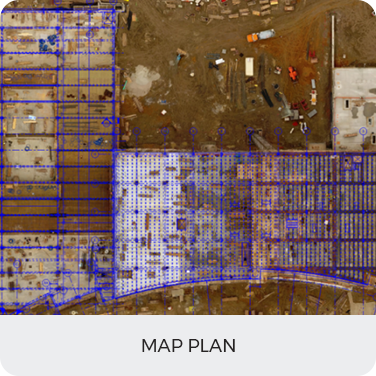
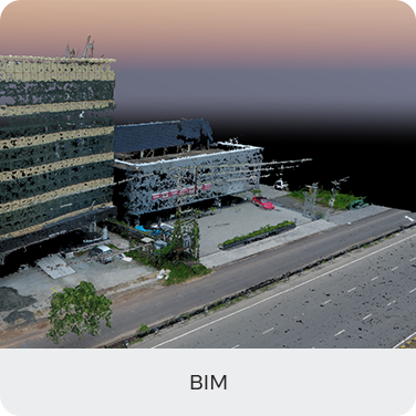
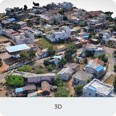
Applications of BIM Drones in Construction

  • Construction Site Mapping: Drone mapping enables accurate drone site mapping for construction, helping engineers generate detailed site models that can be integrated into BIM systems for project planning and layout validation.
  • Construction Progress Monitoring: Using UAV construction monitoring, project teams can track construction progress by comparing real-time aerial data with BIM design models, ensuring that work is aligned with project schedules.
  • Infrastructure Development: BIM drones play a critical role in large infrastructure projects such as highways, railways, bridges, and industrial plants. Drone surveys provide precise mapping data for planning and engineering analysis.
  • Volumetric Analysis: Drone volumetric analysis allows accurate measurement of excavation volumes, stockpiles, and earthwork activities, providing valuable insights for construction planning and resource management.
  • Building Inspection and Structural Monitoring: Drones for building inspection capture detailed imagery of structures, rooftops, and façades, helping engineers integrate inspection data into BIM models for lifecycle management.
  • Digital Twin Development: Combining drone mapping with BIM enables the creation of digital twins, allowing project teams to simulate real-world conditions and monitor infrastructure performance.

Benefits

  • Improved Data Accuracy: Drone photogrammetry provides high-resolution aerial imagery and accurate 3D models that improve the quality of BIM data used for construction planning.
  • Faster Data Collection: Drone surveys cover large construction sites quickly, reducing the time required for traditional surveying methods.
  • Better Project Visualization: 3D models generated from drone data allow stakeholders to visualize construction progress and compare design plans with actual site conditions.
  • Enhanced Collaboration: Integrating drone data with BIM workflows allows architects, engineers, contractors, and project managers to collaborate more effectively using a shared digital environment.
  • Reduced Safety Risks: Drones can inspect difficult or hazardous areas without requiring personnel to access unsafe locations.
  • Cost and Time Efficiency: Drone mapping helps reduce survey costs, minimize project delays, and improve decision-making by providing accurate and timely information.

Deliverables

Map Plan
BIM
3D View

Contact us today to see what we can do for your business

CONTACT US